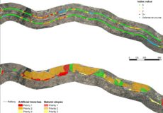
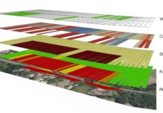
development of an original methodology based on MCA (Multi Criteria Analysis) approach, aimed at assessing landslide hazard along about 400 km of railway lines and supporting decision-makers in defining the most appropriate mitigation measures and planning their implementation.
Basing on an ad hoc survey (airborne lidar and mobile mapping) aimed at the acquisition of detailed geomorphologic data throughout the railway corridor, a procedure based on the weighted sum of spatially distributed geomorphometric indicators was developed.
The Multi-Criteria Analysis (MCA) provides a decision-making tool in complex situations where multiple criteria are involved and a well-structured decision-making process is needed. Moreover, MCA can be applied in a GIS environment when geocoded data are available.
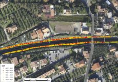
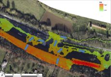
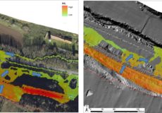
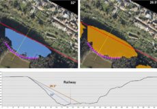
The granularity (or spatial resolution) of the analysis is 10m. Data were processed in GIS environment, providing a synoptic view of the main hydrogeological issues along each studied railway line.
One of the added value of a wide mapping work is the constant update of the data; for this reason a WebGIS platform has been implemented, in order to allow an easy access to the data and to provide an easy-to-use update web service.
After a first pilot section, six railway lines were surveyed and analysed in centre Italy.
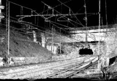
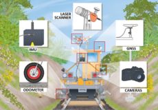
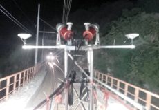
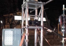
Due to the strong limitations to access the railway restricted area, high-productivity surveying techniques were applied. An integrated mobile mapping system consisting of two rotating laser scanners, INS and GNSS positioning system, odometer and digital cameras was developed; thanks to modularity, the surveying system can be quickly adapted and installed over any railway trailers as well as road vehicles.
The surveying procedure as well as the data processing workflow was originally designed and implemented by IMAGEO.