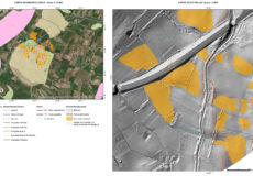
ScadaGeo is a system/service aimed at realizing hydrogeological hazard/risk maps of the areas crossed by linear infrastructures e.g. Roads, Railroads and FlowLines.
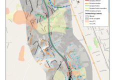
ScadaGeo provides a synoptic view of the hydrogeological hazard/risk along the selected infrastructure by using an objective and repeatable approach.
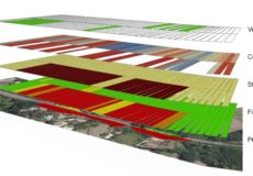
ScadaGeo is a Multi-Scale approach based on progressively more detailed levels of analysis: the most detailed in-depth investigations are applied only to the sections that have been highlighted as critical in lower-resolution analysis.
The system front-end is a WebGIS service that allows spatial data visualization through a common browser, as well as the use of customised geo-services, such as tools to send and receive georeferenced notifications from any device, both pc or mobile.
ScadaGeo has already been used by Italian railroads and highways companies (RFI and Autostrade per l’Italia).
The use of ScadaGeo supports the infrastructure operator in optimizing mantainance costs and providing proof of the operator’s commitment to the protection and security of the infrastructures.
ScadaGeo applications have been so far carried out also in partnership with TRE-Altamira, SPEA Engineering, ETS Engineering, Studio Geologico Epifani.
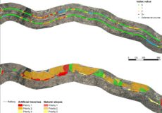
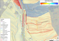
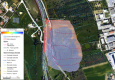
A more detailed description of the experience along the railway lines is given here.