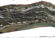
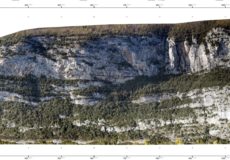
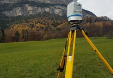
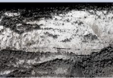
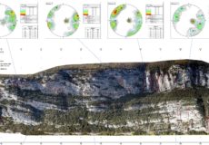
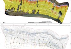
Laser scanner scanning and helicopter photogrammetric survey of a rocky slope (1200m x 500m h) aimed at supporting the design of rock falls defense works on SP 11 ‘della Val d’Adige’ (Northern Italy).
The work have been made by returning an accurate three-dimensional digital model of the area, at drafting cartographic elaborations, at the geomechanical characterization and identification of unstable volumes and trajectory simulations.
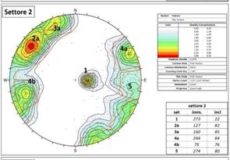
The structural analyses performed on the detailed 3D model allowed the identification of the fracturing state of the rocky walls, whose geomechanical parameters (spacing, Jv, VRU) have been calculated on over 250 observation windows.
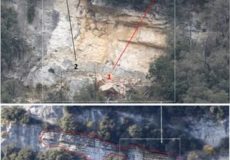
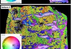
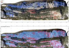
From the comparison among direct visual analysis of the wall, high resolution images from UAV, kinematic analyses and geomechanical parameters extrapolated from the 3D model, 142 potentially unstable parts were identified.
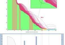
2D and 3D simulations have been performed along 25 sections.